1
/
of
1
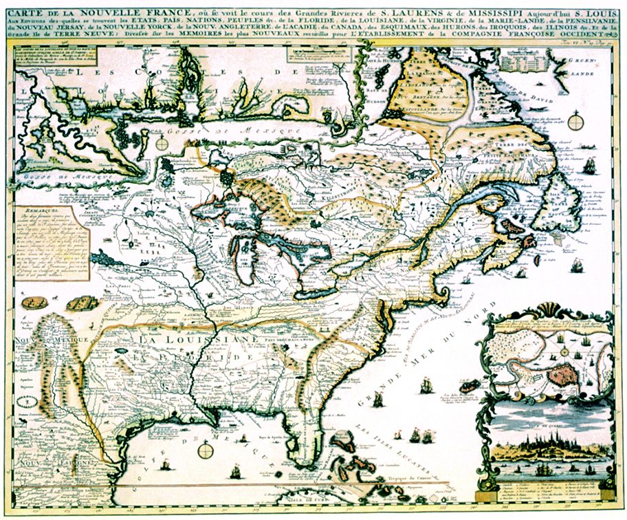
New France 1719 Map
New France 1719 Map
Regular price
$25.95 USD
Regular price
Sale price
$25.95 USD
Unit price
/
per
Shipping calculated at checkout.
Couldn't load pickup availability
15 1/4" x 18 1/4". Châtelain's map of the French domain in North America is a single sheet version of the multi-plate engraving by Nicolas de Fer published a year earlier. It includes a fine insert plan and view of Quebec and, at the top, an enlargement of the area from the Mississippi River to Pensacola Bay. Indian villages, animals, ships, and sea monsters add decorative appeal to this splendidly colored and highly detailed map. Colored, Text Weight Paper.
Share